Unfortunately, I could not glean enough information by just looking at Linn’s diary entries. Using other tools such as ArcGIS was extremely helpful and beneficial. This source revealed how Lynn had a huge role in the Civil War and participated in many significant battles. We also see how he appeared in many different places during the war. ArcGIS showed where the locations were in relation to one another. By seeing a clear layout of the map, I was able to have a better overall understanding of Linn’s participation in the Civil War. ArcGIS has a feature where you can add map notes, which was very beneficial for me. Adding map notes helped to connect the different “clues” Linn was giving. For example allowed me to connect what I knew about the battles of Roanoke and South Mills.
At first, I did not understand the purpose of GIS. I did not grasp the concept of reading words and thinking of them as places. It was extremely frustrating and I was hesitant about the overall process. For example, I was reading about musketry and had no idea how to think of that as being a place on a map. I eventually realized I think of the center location as the medial part of the civil war, so musketry must be located in the middle.
GIS enables students to learn more information and get a better understanding of history. “(Bodenhammer 21) Archaeologist came early to GIS, as well as to other spatial instruments such as global position systems in large measure because it provided a handy and more accurate toolkit for managing their research in familiar but speedier ways” (21). ArcGIS reveals Linn’s participation in the civil war in a more accurate and succinct way.
Visual learning helped me to understand and learn more about Linn in the Civil War. “GIS relies heavily on visualization to display its results” (24). One example of the visualization displayed on the map is the hospital. It was extremely helpful to see where other places were in relation to his location. When Linn was passing by the hospital, I was able to see that he was near fort Hugers and the routes of the escaped rebels.
ArcGIS is a form of close reading. You are visually presented with a map, versus just reading words. Bodenhammerr said “GIS is fundamentally what happens in a geographic space (page 23)”. Basically, It enables us to take what we have read and be able to visualize it in a way that provides us with more helpful information. By the end of this project, I enjoyed using GIS. It ultimately helped me have a better understanding about Linn’s participation in the Civil War.
Click below to see my final product! :

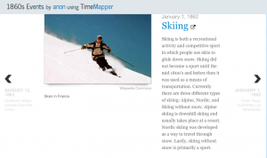 not mention any important historical events that occurred outside his life in the Civil War. For example, skiing was invented in the same winter when Linn was writing in his diary. Although he did not have the Internet or any technology that would have allowed him to gain access quickly, I assume that word of a new sport like skiing would have been spread about in the United States as well, but there was no mention of skiing or any important event that occurred outside of his immediate realm.